Hero

Services

EGS Survey Services

Hydrographic and Geophysical Surveys

Hydrographic and Geophysical Surveys

Positioning and Construction Support

Positioning and Construction Support

Metocean and Marine Environment

Metocean and Marine Environment

Geotechnical Services

Geotechnical Services

Marine Minerals Services

Marine Minerals Services

UXO Surveys

UXO Surveys

Hydrographic and Geophysical Surveys

We conduct hydrographic and geophysical surveys and more commonly projects combining both these disciplines. From adhering to IHO S-44 standards (ranging from Exclusive Order to Order 2), typically reserved for ensuring vessel navigation safety, supporting dredging operations, and producing navigational charts, to conducting route and engineering surveys, search operations, pipeline inspections, and infrastructure mapping, as well as environmental and habitat assessments and feasibility studies.

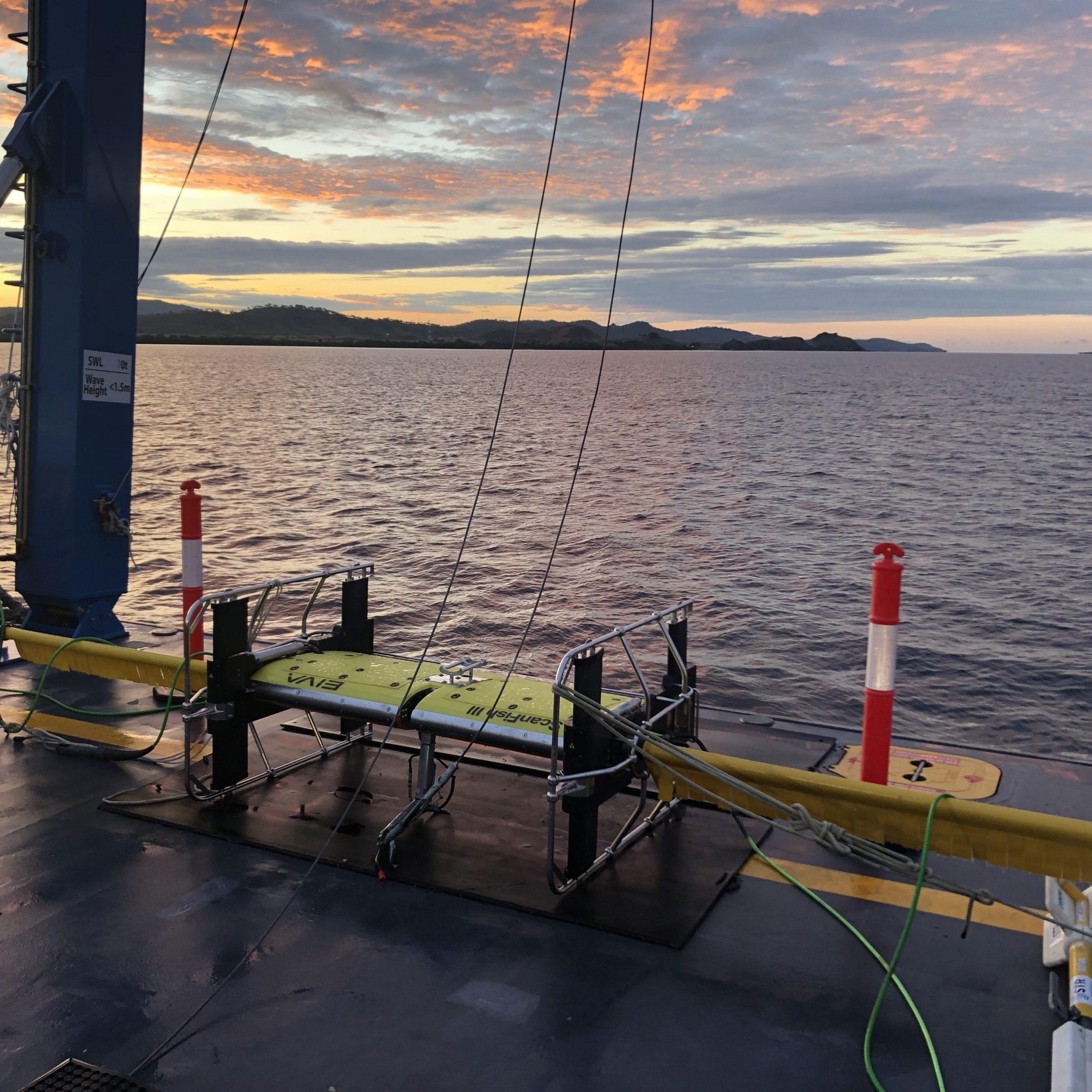
With an extensive inventory of survey equipment, we offer hydrographic and geophysical survey solutions from coastal environments to full ocean depths. Our typical projects involve using high-resolution multibeam echo sounders (including shallow water-specific and deep water-specific systems), side scan sonars, sub-bottom profilers (pingers, chirps, sparkers, boomers), high-resolution digital seismic systems, and refraction systems.

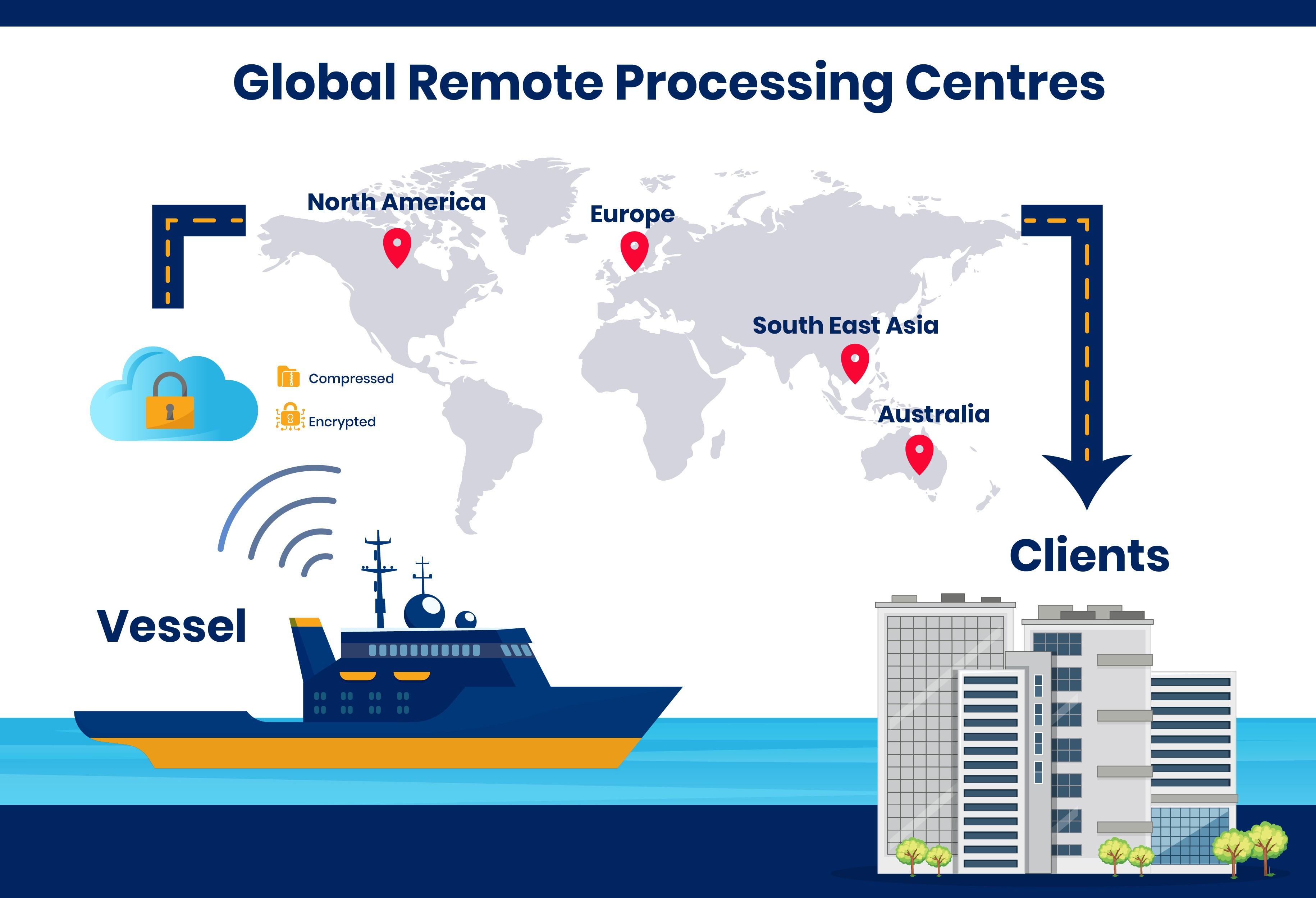
In the Energy, Submarine Telecommunications, and Marine Infrastructure sectors, EGS delivers near real-time reports by seamlessly integrating data acquisition and processing from multiple survey equipment, meeting client deadlines. This can all be achieved offshore or from our Remote Process Centres as per project requirements.

Positioning and Construction Support

Our offshore construction personnel possess diverse expertise, enabling us to customise teams according to your project requirements. Our project managers, engineers, and surveyors are encouraged to be innovative in finding optimal solutions for our clients, seamlessly integrating with existing teams to reduce costs and enhance safety throughout the project lifecycle.

EGS provides a comprehensive suite of survey and positioning services to support offshore construction, including:

  • Dimensional control surveys for various structures such as FPSOs, TLPs, SPARs, semi-subs, and jackets, as well as pre-fabrication of hook-up spools and fabrication verification surveys.
  • Surface positioning support and Tug Management Systems (TMS) for tasks such as FPSO hook-ups, rig moves, multi-vessel positioning, and remote monitoring and quality control from shore.
  • ROV survey and inspection support for tasks including as-built surveys, Inspection, Maintenance, and Repair (IMR) operations, and out-of-straightness surveys.
  • Installation support services encompassing LBL jumper and spool piece metrology, pile guide frame positioning, and touch-down monitoring.

Metocean and Marine Environment

We deploy equipment, offshore, near shore or onshore for measuring wave height, weather or currents through the whole water column for short term; over a few days, or long term; over several years. We also routinely measure multiple seawater parameters, either on the sea surface or as a profile through the whole water column, such as temperature, salinity, turbidity, dissolved oxygen and methane.

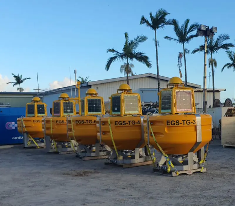
We will plan and deploy equipment arrays needed to model tide datums over your work area. This can range from complex water level measurements from multiple sensors over a large area for several months to a single tide gauge installed on shore for a matter of hours. We will recommend the best cost-effective solution tailored to your requirements.

Geotechnical Services

  • Deep Ground Investigation is carried out using a dedicated drillship operating in water depths from 15 to 200 metres. The vessel is equipped with a 5 inch API down-the-hole (DTH) drill system capable of penetrating up to 200 metres.
  • Shallow Ground Investigation is performed using light geotechnical equipment on vessels and in selected cases, regional nearshore operations are supported with jack-up platforms.
  • Onboard and quayside laboratory services ensure controlled sample management and customised geotechnical laboratory testing to meet specific client requirements.
  • Geotechnical techniques include:
    • Rotary, vibratory, and push coring
    • Piezocone penetration testing (CPTu), including seismic module
    • P-S logging and measurement while drilling (MWD)
    • Various in-situ testing and DTH tools

By integrating these geotechnical methods with EGS’s geophysical and hydrographic expertise, the EGS Group delivers a comprehensive suite of geo-survey services. This enables accurate seabed characterisation, supporting confident and informed decisions in marine infrastructure development.

Marine Minerals Services and Investor Consulting

EGS has been surveying the deeper, more remote parts of the world's oceans for over half of a century. As a premier provider of global marine geoscience solutions, EGS supports the growing marine minerals industry with advanced services that reduce risk, accelerate exploration, and streamline development built on decades of deepwater and remote operations survey experience.

Marine Mineral Investor Consulting

  • Exploration strategy consulting
  • Survey design and method development and vetting
  • Reserve estimate analysis
  • Comprehensive and tailored risk analysis and assessments

Desktop Studies & Strategic Site Assessments

  • Basin-wide reviews using legacy and open-source data
  • Geological prospectivity analysis for polymetallic nodules, sulphides, and crusts

Advanced Data Processing & Interpretation

  • High-resolution reprocessing of multibeam, sidescan, magnetics, and sub-bottom data
  • Integrated interpretation of geophysical, geochemical, and biological datasets

Environmental Modelling & Simulation

  • Seafloor geohazard modelling (slope stability, faulting, terrain roughness)
  • Oceanographic simulations for mining system and vessel planning

Strategic & Engineering Advisory

  • Guidance on exploration sequencing, target prioritisation, and feasibility.
  • Input to mining system placement, cable routing, and infrastructure layout.

UXO Surveys

We provide Unexploded Ordnance (UXOs) detection surveys for all types of offshore projects. Typical clients include port authorities, oil & gas companies, renewable energy companies, cable installers, dredgers, and offshore contractors. We offer bespoke solutions, often working with UXO consultants, to generate survey designs to optimise efficiency whilst acquiring high density, high quality data for UXO assessment.

Working in accordance with International Mine Action Standards (IMAS 09.06) and Offshore Wind Accelerator Guidelines, EGS would typically deploy the following equipment for UXO detection surveys:

Offshore

  • Four marine magnetometers towed with EIVA Katria Scanfish ROTV.
  • High resolution multibeam echo sounder.
  • High resolution side scan sonar.

Nearshore

  • Two marine magnetometers towed in TVG frame.
  • High resolution multibeam echo sounder.
  • High resolution side scan sonar.

Data Processing

  • Data processed using industry standard Oasis Montaj software.
  • Results filtered to select potential UXO targets for further investigation (visual ID using ROV), or for avoidance by repositioning of infrastructure to be installed.

ALARP Certification

  • Risk reduction certification to ALARP criteria issued in conjunction with UXO consultants

Remote Support and Processing

For over 50 years, EGS has been synonymous with professional excellence, delivering unmatched efficiency and precision. Today, we're taking innovation to the next level.

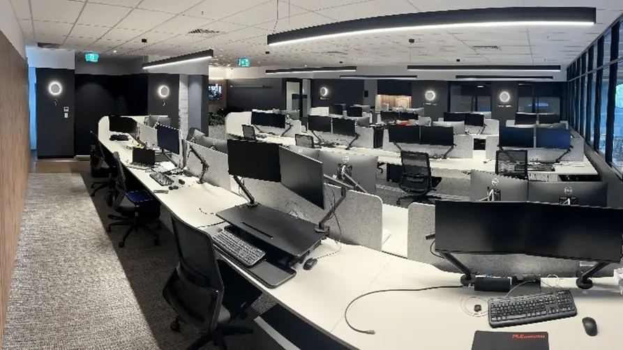
With advancements in data transfer and the power of our globally distributed yet independently functioning Remote Processing Centres (RPCs), EGS has increased the efficiency of survey acquisition, data processing and reporting like never before.

Remote Support and Processing

Data Management and Compression

  • Senior geoscientists and hydrographic surveyors in field for data quality control
  • Survey data is compressed using EGS's proprietary encrypted compressing software

Auto Transfer of Data

  • Dedicated satellite internet (Starlink) ensures stable and efficient data transfer
  • Automatic uploading of compressed data from project sites to EGS's secure and globally distributed RPCs

Processing, Synchronization and Real-time Communication

  • Processing of data can be shifted to office-based teams, reducing the need for offshore personnel
  • Processing teams in RPCs work on shifts 24/7, ensuring real-time quality control, processing and reporting
  • Real-time monitoring and communication via CCTV, audio and remote access to offshore computers create virtual offshore environment in the RPCs

Benefits to Projects

  • Reduced carbon footprint due to less people travelling offshore
  • Less people offshore also mean less exposure to health and safety risks
  • Flexible size of project teams not reliant of cabin spaces on vessels
  • Worldwide and optimised expertise for projects varying from local to global scales
  • Timely monitoring and decision-making
  • Real-time quality control, data processing and reporting
  • Strengthened data security with encrypted compression
Remote Support and Processing

Interested in our services?